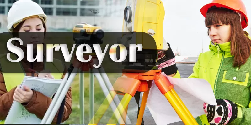
🌟 ITI Trade: Surveyor 🌟
🎓 Overview
- Powered by: NCVT (National Council for Vocational Training)
- Job Orientation: A job-oriented trade designed to prepare you for roles in both government and private sectors
- Self-Empowerment: Equips you with advanced surveying skills to work independently or pursue entrepreneurial ventures
- Global Relevance: Perfectly designed to fulfill the industrial requirements of Indian and international industries
- Course Duration: 1 year
- Certification: On successful completion, trainees are awarded the National Trade Certificate (NTC) by NCVT, recognized worldwide
- Delivery Mode: Courses are delivered nationwide through a network of ITIs under modern vocational training schemes
💡 Why Choose ITI Surveyor?
- ✅ Job-Oriented Training:
- Learn both theoretical and practical aspects of surveying, ensuring you are immediately job-ready.
- Gain hands-on experience in handling surveying tools, equipment, and instruments including Total Stations, Leveling instruments, and Theodolites.
- Master essential surveying techniques such as chain/tape surveying, plane table surveys, and advanced digital methods.
- ✅ Diverse Career Opportunities:
- Government Jobs:
- Secure roles in public works, municipal planning departments, and infrastructure projects.
- Private Sector Roles:
- Work in engineering firms, construction companies, and surveying consultancies.
- Self-Employment & Contractual Work:
- Start your own surveying consultancy or work as a freelance surveyor on various projects.
- Industrial Jobs:
- Engage in large-scale industrial surveying projects such as road surveys, earthwork computation, and CAD-based plan preparation.
- Government Jobs:
- ✅ Industry-Relevant Curriculum:
- The curriculum is divided into two main blocks covering a wide range of surveying techniques and methods:
- Block-I: Fundamental drawing, scaling, chain and tape surveying, prismatic compass, plane table, and basic road project surveying.
- Block-II: Advanced techniques including contour mapping, Theodolite and Digital Theodolite surveys, tachometric methods, Total Station operation, and CAD plan preparation.
- Emphasis on both domain-specific theory and practical hands-on training ensures a thorough understanding of modern surveying methods.
- The curriculum is divided into two main blocks covering a wide range of surveying techniques and methods:
- ✅ Self-Empowerment & Career Growth:
- Develop the confidence and technical acumen needed to manage complex surveying projects.
- Enhance your problem-solving abilities through real-world project work and internal assessments.
- Prepare to excel in various roles by mastering the latest digital and manual surveying techniques.
🏆 Career Opportunities After Completion
After successfully completing the ITI Surveyor course, you will be prepared to assume a wide range of roles within the surveying and civil engineering sectors. Potential career roles include:
- 📐 Surveyor – General:
- Conduct a variety of surveying tasks including field surveys, site planning, and data analysis.
- Use both traditional tools and modern digital instruments to produce accurate site plans and drawings.
- 🔍 Total Station Operator:
- Operate Total Stations for high-precision measurements on large projects such as road surveys, infrastructure development, and land surveys.
- Integrate digital data into computer-aided design (CAD) systems to prepare detailed plans.
- 📏 Leveling & Theodolite Specialist:
- Utilize various leveling instruments and Theodolites to determine precise elevations and angular measurements.
- Prepare detailed reports and charts for infrastructure projects, ensuring compliance with engineering standards.
- 🛣️ Road Surveyor:
- Conduct surveys for road projects, showing long and cross-sections, and compute earthwork requirements.
- Apply both traditional and tachometric methods to determine distances and angles accurately.
- 📊 CAD Plan Preparation Specialist:
- Use computer-aided design tools to convert survey data into accurate plan drawings.
- Collaborate with engineers and architects to ensure that the designs meet project specifications.
- 💼 Self-Employed Survey Consultant:
- Establish your own surveying consultancy, offering specialized services to various industries.
- Leverage your skills to work on contractual and freelance projects.
📚 Course Structure & Learning Outcomes
The ITI Surveyor course is meticulously designed to provide a robust understanding of surveying through two main blocks, each covering essential techniques and skills.
Block-I: Fundamental Surveying Techniques
- Module 1: Drawing & Scaling Techniques
- 🔹 Plane Figure Drawing:
- Learn to draw plane figures using standard drawing instruments, ensuring proper layout and scale.
- Practice folding drawing sheets and understanding the method of layout.
- 🔹 Scale Construction:
- Construct various types of scales including plain, comparative, diagonal, and vernier scales.
- Develop the ability to select and use the appropriate scale for different surveying needs.
- 🔹 Plane Figure Drawing:
- Module 2: Orthographic Projections & Site Planning
- 🔹 Orthographic Projections:
- Learn to draw orthographic projections of objects with correct lines, lettering, and dimensioning.
- Understand the importance of accuracy in technical drawings.
- 🔹 Chain/Tape Surveying:
- Master the use of chains and tapes for field surveys.
- Prepare detailed site plans based on measurements taken with traditional methods.
- 🔹 Orthographic Projections:
- Module 3: Compass and Plane Table Surveys
- 🔹 Prismatic Compass Survey:
- Learn how to use a prismatic compass for basic site surveys.
- Prepare accurate site plans by applying compass readings.
- 🔹 Plane Table Survey:
- Practice conducting plane table surveys and translating field data into detailed maps.
- Understand the principles of direct plotting and measurement on the field.
- 🔹 Prismatic Compass Survey:
- Module 4: Road Project Surveying with Leveling Instruments
- 🔹 Long & Cross-Section Surveying:
- Use leveling instruments to survey road projects.
- Prepare drawings showing both long and cross-sections of the surveyed road.
- 🔹 Earth Work Computations:
- Compute earthwork requirements based on survey data.
- Develop the skills to analyze terrain and prepare accurate estimations.
- 🔹 Long & Cross-Section Surveying:
Block-II: Advanced Surveying Techniques
- Module 5: Contour Mapping & Advanced Leveling
- 🔹 Contour Map Preparation:
- Use leveling instruments to create contour maps of surveyed areas.
- Learn to interpret contour lines and identify elevation changes.
- 🔹 Contour Map Preparation:
- Module 6: Theodolite & Digital Surveying
- 🔹 Theodolite Surveying:
- Perform site surveys using a traditional Theodolite.
- Prepare detailed site plans based on angular measurements.
- 🔹 Digital Theodolite:
- Utilize digital Theodolites to enhance the precision of your surveys.
- Integrate digital data into the survey process for improved accuracy.
- 🔹 Theodolite Surveying:
- Module 7: Road & Tachometric Surveying
- 🔹 Tachometric Methods:
- Learn techniques for the tachometric determination of distances and angles.
- Apply these methods to prepare site plans for road projects.
- 🔹 Road Surveying:
- Conduct comprehensive road surveys, including determination of slopes and earthwork calculations.
- 🔹 Tachometric Methods:
- Module 8: Total Station & CAD Integration
- 🔹 Total Station Operation:
- Master the use of Total Stations for high-precision surveys.
- Collect and process field data to prepare accurate site plans.
- 🔹 Plan Drawing with CAD:
- Learn to convert survey data into detailed plan drawings using CAD software.
- Develop digital documentation skills essential for modern surveying.
- 🔹 Total Station Operation:
- Module 9: Measurement & Quality Control
- 🔹 Instrument Calibration & Measurement:
- Select and ascertain measuring instruments to measure dimensions accurately.
- Record and analyze data to ensure high-quality survey outputs.
- 🔹 Fault Detection & Documentation:
- Learn to check circuits, equipment, and panels as per technical drawings.
- Document technical parameters and rectify any detected faults or defects.
- 🔹 Instrument Calibration & Measurement:
- Module 10: Basic Training, Internal Assessment & Examination:
- 🔹 Hands-On Projects & Field Work:
- Engage in practical projects that simulate real-world surveying challenges.
- Apply your knowledge to fieldwork assignments and present project findings.
- 🔹 Revision & Assessment:
- Participate in revision sessions and internal assessments to consolidate learning.
- Complete a final examination to validate your skills and receive your certification.
- 🔹 Hands-On Projects & Field Work:
🎯 Key Learning Outcomes
After completing the ITI Surveyor course, you will be able to:
- Perform Fundamental Surveying Techniques:
- Accurately draw plane figures and construct various scales for precise measurements.
- Prepare orthographic projections and detailed site plans using chain/tape, compass, and plane table methods.
- Conduct Advanced Field Surveys:
- Use leveling instruments for road project surveys, including long & cross-section drawings.
- Create contour maps and perform comprehensive surveys using traditional and digital instruments.
- Operate High-Tech Survey Instruments:
- Master the use of Theodolites, Digital Theodolites, Total Stations, and tachometric methods.
- Integrate survey data into CAD software to produce professional plan drawings.
- Apply Measurement and Quality Control Techniques:
- Select and use various measuring instruments, record data accurately, and ensure quality through rigorous testing.
- Identify and rectify faults or defects in surveyed components according to technical standards.
- Document and Report Survey Findings:
- Prepare detailed technical documentation, including field reports, plan drawings, and measurement records.
- Maintain accurate records that support quality assurance and future project planning.
- Develop Soft Skills and Professionalism:
- Enhance communication, teamwork, and time management skills essential for a dynamic work environment.
- Cultivate a professional work ethic and adhere to safety standards, environmental regulations, and housekeeping practices.
- Embrace an Entrepreneurial Mindset:
- Gain the confidence and skills to start your own surveying consultancy or work on contractual projects.
- Understand market trends, customer requirements, and business planning fundamentals to boost your career growth.
🌍 Industry Scope & Employability
- Wide-Ranging Career Opportunities:
- The skills acquired in this course open doors to multiple roles in the surveying and civil engineering sectors, such as:
- Surveyor – General: Conduct field surveys, prepare site plans, and produce technical drawings.
- Total Station Operator: Utilize digital instruments for high-precision surveying projects.
- Road and Infrastructure Surveyor: Work on road projects, perform leveling and tachometric surveys, and compute earthwork requirements.
- CAD Specialist in Surveying: Convert field data into digital plan drawings using advanced software.
- The skills acquired in this course open doors to multiple roles in the surveying and civil engineering sectors, such as:
- Sectoral Opportunities:
- Government Organizations:
- Work in public works departments, municipal planning, and government infrastructure projects.
- Private Firms:
- Secure roles in construction companies, engineering consultancies, and private surveying agencies.
- Self-Employment & Contractual:
- Establish your own surveying firm or offer freelance consultancy services on a contractual basis.
- Government Organizations:
- Future Prospects:
- With additional certifications and industry experience, progress to supervisory or managerial positions in surveying and project management.
- Advanced studies in civil engineering, geospatial technology, or architecture can further enhance your career trajectory.
- The globally recognized NTC certification from NCVT provides a competitive edge in both domestic and international job markets.
🔥 Start Your Journey Today!
- If you are passionate about:
- Surveying & Field Work: Ready to work with modern instruments and techniques to map and measure real-world sites.
- Technical Precision: Eager to master both traditional and digital surveying methods for accurate data collection.
- Career Growth & Self-Empowerment: Looking to build a rewarding career with diverse opportunities in the surveying and civil engineering sectors.
- Entrepreneurship: Interested in starting your own surveying consultancy or working on contractual projects independently.
- Then, the ITI Trade: Surveyor course is perfect for you!
- Enroll now to gain:
- A comprehensive curriculum that blends rigorous theoretical instruction with extensive hands-on training.
- In-depth knowledge of both fundamental and advanced surveying techniques.
- A globally recognized National Trade Certificate (NTC) by NCVT to boost your employability.
- The confidence and expertise to excel in diverse roles across government, private, and self-employed sectors.
- Enroll now to gain:
- Join now and transform your future:
- Embrace the opportunity to work with cutting-edge surveying technology and methods.
- Contribute to the development of infrastructure and quality civil engineering projects.
- Step confidently into a career that offers stability, growth, and the potential for self-employment.
👉 Enroll Today & Chart a Successful Career in Surveying! 🚀📏✨